To download the Approved Model list (AML) for Part 23 Aircraft click here.
Top Features

Avidyne’s IFD Series is the most intuitive Flight Management System with an easy-to-use, yet powerful design
IFD series provides SBAS/LPV precision navigation and meet the accuracy and integrity requirements for the NextGen airspace initiative of ADS-B
The IFD series are direct, slide-in replacements of GNS navigators utilizing your existing tray and are compatible with all popular interface configurations greatly minimizing aircraft downtime and installation costs.
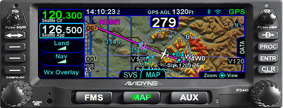
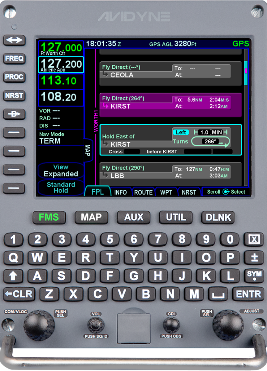
Hybrid Touch touchscreen with Knobs and Buttons makes the IFD Series popular with pilots because knobs and buttons are preferred in turbulent weather.
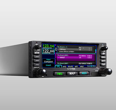
The IFD user interface reduces button pushes and knob twists by up to 75%. Dropdown menus provide easy entry of airways, exit waypoints, destinations, and approach procedures. One-touch user-defined waypoints, plus pinch-zoom, map panning, and graphical flight plan editing, make operation a breeze.
FMS Preview loads flight plans and displays real-time graphical depictions of each proposed modification in cyan before selection and makes it easy to visualize the desired waypoint, airway, hold or hold entry, Direct-To, approach, approach transition and terminal procedures before selection. You can quickly load any number of destination airports and multiple approaches into your flight plan.
GeoFill™ intelligently predicts your next waypoint entry, not based on its order in the database, but on its proximity to your current location or the previous waypoint in your flight plan.
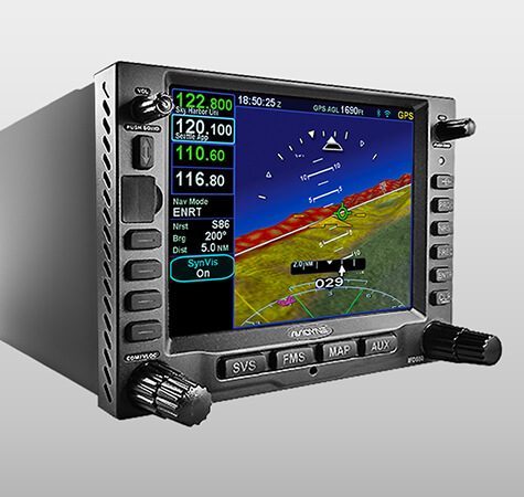
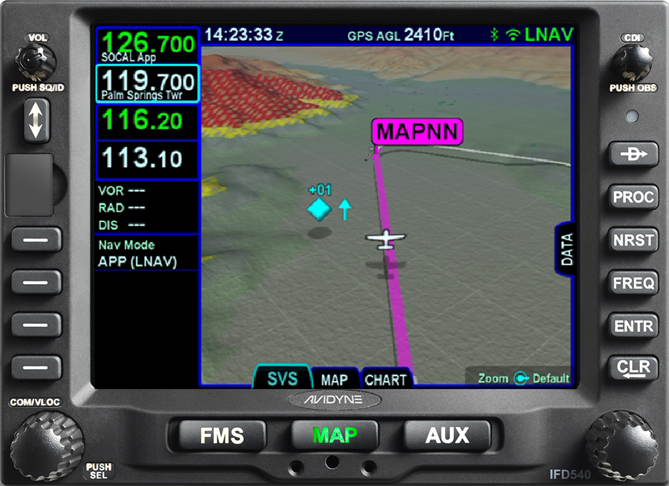
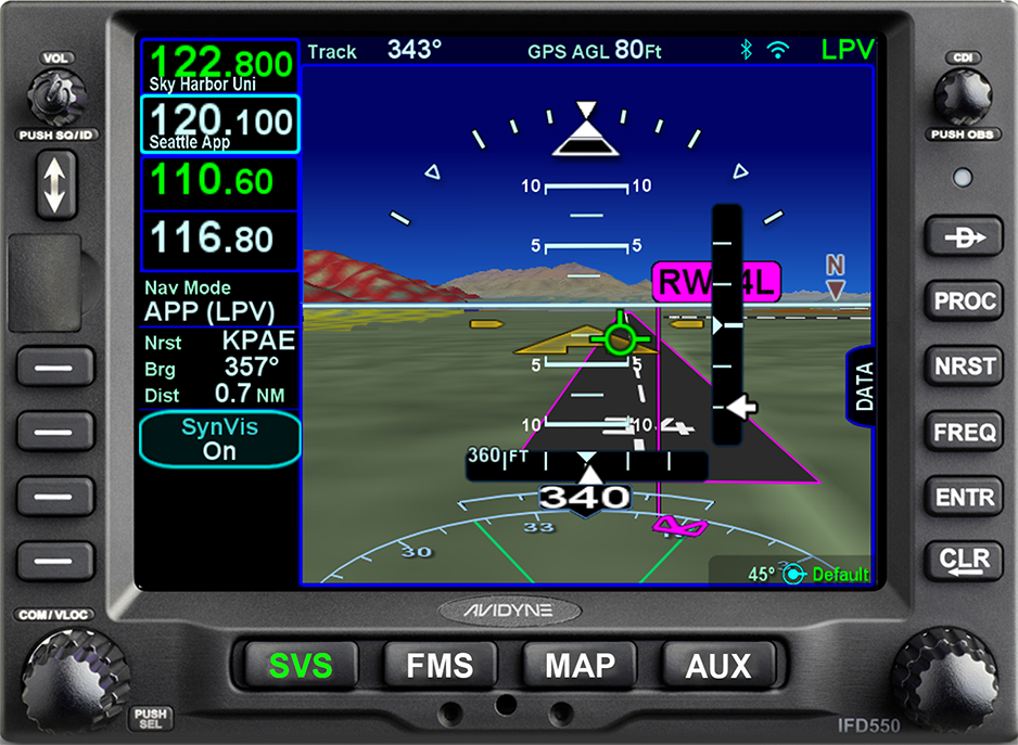
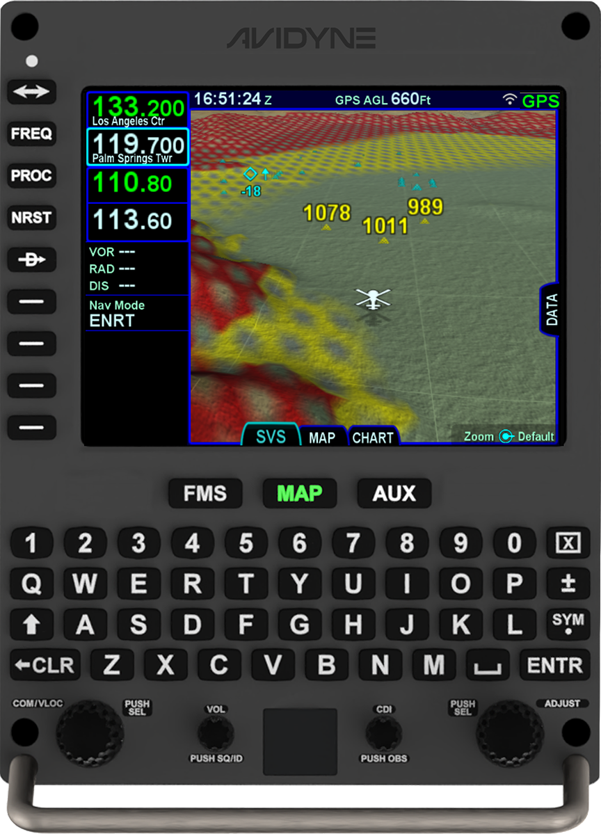
Avidyne’s beautiful 3D Synthetic Vision (SVS) is fully integrated and is included on all IFD series for improved situational awareness without the need for additional boxes or wires.
3D Terrain Awareness and Forward-Looking Terrain Alerting (FLTA) displays over the color-contoured terrain base map advising of imminent encounters with terrain and actively projects the aircraft’s flight track notifying if a collision is imminent. Caution Alerts occur if a collision is projected within 60 seconds and Warning Alerts occur if collision is projected within 30 seconds.
With multiple Frequency Display formats and Station I.D. Readout, communications are greatly improved with the IFD Series. Active and standby frequencies are decoded based on proximity in the database and display the names of the stations in plain English, providing a handy reminder of the agency you will be transmitting to when pressing the push-to-talk button.
3D Traffic uses standard traffic symbology indicating relative threats by their size and relative altitude and bearing. As traffic draws nearer to you, the symbols grow in size on your IFD.
Airfields are depicted with METAR-style flags when in the field of view. With valid METAR data from your datalink, airfield flags will be color-coded to represent the ceiling and visibility, consistent with the moving map presentation.
When connected to a compatible Fuel Totalizer System, the IFD series displays a dashed green circle indicating a fuel reserve of 45 minutes while a green Fuel Range Ring indicates the maximum range without reserve.
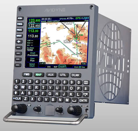
The IFD5-Series includes CMax™ Electronic Approach Charts & Airport Diagrams utilizing Jeppesen’s Jeppview® charts subscription services. IFD5-Series also supports optional European VFR (Bottlang) Charts for over 2,200 airports in 29 European countries.
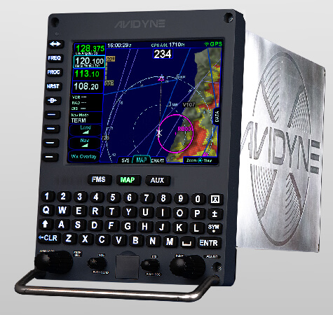
The IFD’s built-in WiFi and Bluetooth® provides connectivity to the IFD 100 App on your AppleiPad ® and a growing list of third-party Apps, plus the included MK10 remote Bluetooth keyboard for complete wireless control of your panel-mount IFD.
All IFD series include open wireless connectivity to third-party flight planning and mapping applications such as ForeFlight ® Mobile EFB, FlightPlanGO ®, Seattle Avionics FlyQ ®, AvPlan ® EFB, SkyDemon™ and Cloud Ahoy ®.
Radios Frequencies can easily be entered either by rotating the dual knobs or by using the touch-screen numeric keypad on the IFD 550, 540, and 440. COM frequencies can be tuned directly by touching the displayed frequencies on Info, Nearest, and Frequency List pages and can simultaneously tune both the active and standby frequencies.
Avidyne IFD’s powerful FMS automatically nominates, auto-tunes, identifies, and monitors NAV radio frequencies and automatically tunes to VOR or ILS frequencies.
All IFD Navigators are built on a dual databus architecture for full compatibility with other Avidyne’s panel-mounted avionics.
Standard high, low and grouping symbology depicts 3D Obstacles on the SVS display.
Featured Products

Comparison Chart
FMS/GPS
VHF Nav
VHF COM
3D SVS
ARS + Dynamic SVS
WiFi/BT
Radar
Video
IFD440
N/A
N/A
N/A
IFD540
N/A
OPTIONAL
OPTIONAL
IFD550
Optional
Optional
Avidyne Helios™
Optional
Optional
Avidyne Atlas™
Optional
Optional
FMS/GPS
VHF Nav
VHF COM
3D SVS
ARS + Dynamic SVS
WiFi/BT
Radar
Video
IFD440
N/A
N/A
IFD540
OPTIONAL
OPTIONAL
IFD550
Optional
Optional
Avidyne Helios™
Optional
Optional
Avidyne Atlas™
Optional
Optional
IFD Series Trainer
You wouldn’t buy an aircraft before a test flight would you? That’s just one of the reasons Avidyne created the IFD Trainer.*
Now you can virtually “take a flight”, introduce yourself to the interface, and experience all the technology Avidyne built into the IFD series. Experience the Hybrid touchscreen and the knobs and buttons.
*Only available on iPad