Avidyne Helios

Model #: 850-00195-020

Up to 2-Year Limited Warranty

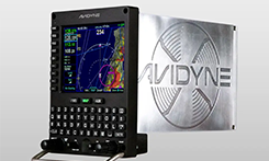
Multifunction SBAS Flight Management System for Helicopters

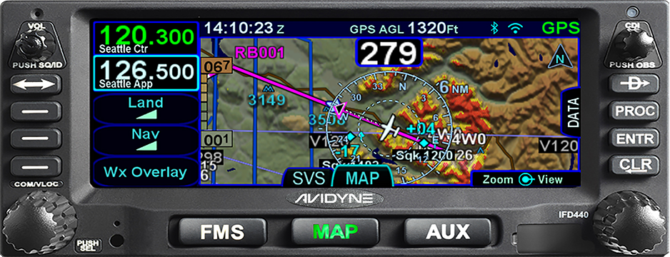
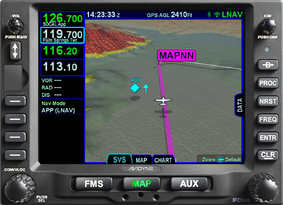
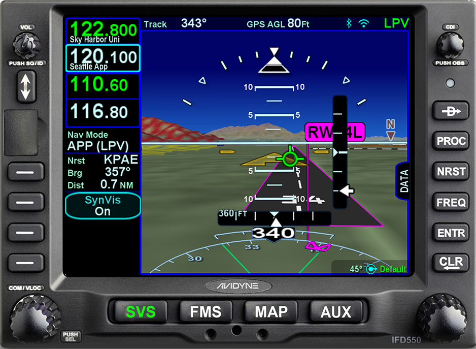
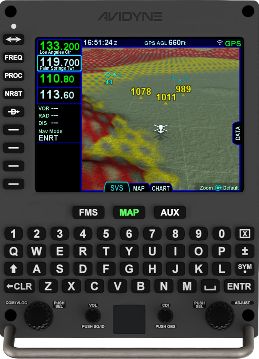
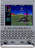
Helicopters require avionics specifically designed for the unique rigours of corporate, military and special mission rotary-wing flight which is why we created Avidyne Helios. Helios is a new multifunction Satellite-Based Augmentation System (SBAS) flight management system that provides full Required Navigation Performance (RNP) and Area Navigation (RNAV) capability, including Localizer Performance with Vertical (LPV), Lateral Navigation/Vertical Navigation (LNAV/VNAV), LNAV-Only, and Approach Procedures with Vertical (APV) approach modes in a dzus-mount.

But true capability required ease-of-use which is why we built-in features like easy flight planning, one-touch departure, airway, and arrival navigation, and included our patented GeoFill™ waypoint nomination. We even included a full keyboard and touch-screen input for easy map panning and flight plan editing.

Features


  • TSO-C146c for full SBAS/LPV approach guidance
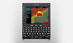
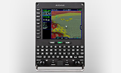
  • Display of XM or ADS-B weather with full graphics overlay
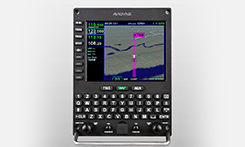
  • Displays Jeppesen™ Electronic Approach Charts and Airport Diagrams including Heliports
  • QWERTY-style dedicated keyboard along with touch-screen hybrid touch user interface
  • Traffic display from TCAS, TAS, or ADS-B

Display

  • 5.7” Diagonal w/Touch Screen
  • Full VGA - 640 x 480 pixels
  • 65,535 colors
  • Ultrabright sunlight readable w/LED Backlighting

Dimensions

  • Width: 5.750” (190.50mm)
  • Height: 7.500“ (146.05mm)
  • Depth: 11.900“(302.26) behind panel including connectors

Weight (including tray and connectors)

  • 8.50 lbs (3.855 kgs)

Power Requirements

  • 11 – 33VDC
  • 2.2A/4.0A XMIT @ 28vdc

VHF & VOR/LOC

  • 16-watt transmitter (Class 3, 5)
  • Simultaneous reception of two channels, voice or data
  • 8.33KHZ or 25KHZ operation (Class C, E)
  • VOR-RTCA DO-196
  • LOC-RTCA DO-1965
  • UHF GS-RTCA DO-192

GPS

  • 16-Channel GPS/SBAS Receivers
  • RTCA DO-178B and DO-254 Level B
  • RTCA DO-160E
  • Meets DO229D, Beta Class 3
  • Accuracy:
  • - Autonomous Position: 3 meters (CEP 50%), 5 meters (95%)
  • - SBAS Differential Position: 1 meter (CEP), 3 meters (95%)
  • - Velocity Sccuracy 0.1 knots (95%)
  • Dynamics:
  • - Acceleration: 10g max
  • - Speed: 1,000 knots
  • - Altitude: 50,000 ft

Environmental

  • DO 160E
  • To 50,000 Ft
  • -20C to +55C Operating
  • +70C Short Term

SkyTrax 200 Software Release 1.0.1

SKYTRAX200 TRAFFIC DEPICTION ANOMALY (2)

Avidyne Full Line Brochure

Date: 03/22/2019
Part Number: AV848
File Size: 815.30 KB
File Revision: Rev. 01

SkyTrax ADS-B Receiver Pilot Guide

Date: 06/10/2021
Part Number: 600-00334-000
File Size: 2.46 MB
File Revision: Rev01

TAS600 Series Pilot’s Operating Handbook

Date: 03/22/2019
Part Number: 600-00145-000
File Size: 890.59 KB
File Revision: Rev. 09

Service Bulletin

Date: 09/28/2021
Part Number: 601-00190-002
File Size: 407.17 KB
File Revision: Rev 00

SERVICE LETTER

Date: 09/17/2021
Part Number: 606-00190-002
File Size: 131.82 KB
File Revision: REV00

Comparison Chart

IFD440

FMS/GPS NAVIGATOR

IFD540 FMS/GPS NAVIGATOR

IFD550 PREMIUM FMS/GPS/NAV/COM

AVIDYNE HELIOS™

AVIDYNE ATLAS™

FMS/GPS

VHF NAV

VHF COM

3D SVS

ARS + DYNAMIC SVS

N/A

N/A

WIFI/BT

RADAR

FROM 5-SERIES

FROM 5-SERIES

OPTIONAL

OPTIONAL

OPTIONAL

VIDEO

FROM 5-SERIES

FROM 5-SERIES

OPTIONAL

OPTIONAL

OPTIONAL